Please ensure Javascript is enabled for purposes of website accessibility

Assessing the Damage


  • By
  • | 3:26 p.m. July 8, 2011
  • | 2 Free Articles Remaining!
  • Strategies
  • Share

REVIEW SUMMARY
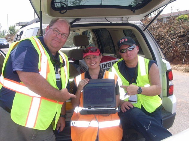
Issue. Assessing disaster damage
Industry. Software
Key. ARM360 can assist governments in directing and receiving resources following a natural disaster.

If Karyn Tareen had been in business when Hurricane Charley slammed into Lee County in 2004, her company could have identified millions of dollars in relief aid the county failed to claim.

Tareen's company, Orlando-based Geocove Inc., has created a software system that helps local governments collect damage assessment information following disasters like hurricanes, fires, floods and tornadoes. The software, ARM360, aids cities and counties in directing recovery resources to appropriate areas.

Just as important, ARM360 allows communities to file quick and accurate damage estimates needed to qualify for federal disaster relief.

“In Lee County they left a lot of money on the table because of inaccurate and incomplete reporting,” says Tareen, who estimates Lee County was eligible for about $3 million more than the county received from the Federal Emergency Management Agency (FEMA).

Tareen's assertions are not just idle claims. The ARM360 system has been field tested in two recent high-profile disasters: the tornadoes in Tuscaloosa, Ala., and Joplin, Mo.

Tuscaloosa Geographic Information System Manager Jeffrey Motz credits the software for helping city officials “rapidly and accurately determine the number of structures affected by the storm.

“Aside from just plotting points on a map, ARM360 also allowed us to put a dollar figure on the storm, thereby helping us to plan for recovery efforts and request appropriate funding,” Motz says.

Gaps in information
Immediately after a disaster, local governments send assessors into the field to gather information on damaged structures, blocked roads or canals, downed power lines and other information needed to begin the recovery process.

In almost all cases assessors use paper forms to file their reports in the field. Those forms are then filed at a command center where a team of people inputs the data into a central database.

In addition, the paper forms must also be cross-referenced with the property appraiser's database to determine the dollar amount of damage to buildings and homes. Those damaged amounts must then be reported to FEMA to receive disaster relief funds.

The process is tedious and prone to gaps in information, which can slow cleanup, delay federal funds and, in the case of Lee County, lead to under-reporting of the actual amount of damage.

“In the event of a hurricane or tornado, it's all about getting the recovery going as quickly as possible,” says Tareen. “To do that, you have to have accurate damage assessment information.”

Wireless access
Local governments already have huge databases of geographic information about their communities. Known as geographic information systems (GIS), these databases are used by property appraisers, planning and zoning departments, public works and other departments that need up-to-date geographical information.

The ARM360 software leverages that GIS information to assist with damage assessments. In Tuscaloosa, for instance, the city's property appraisal information was loaded onto laptops, along with ARM360.

In the field, assessors pull up maps on the laptop that show roads and buildings. The assessor selects a building to be assessed from the map, and with a couple of mouse clicks can report the percentage of damage.

If cellular service is available, that damage report, along with other pertinent information like downed power lines, is immediately transmitted back to a centralized database at the command center. Officials can then immediately use the information to make decisions on recovery and automatically file the appropriate federal relief forms.

If cell service is not available, the information is stored on the laptop and transmitted wirelessly once the device is within range of a working cell tower or the government's wireless network.

“We planned for the worst-case scenario,” Tareen says. “The software works in a totally disconnected situation.”

The ARM360 system not only provides accurate data immediately, it also requires fewer people. In a test run conducted by Osceola County, Tareen says ARM360 saved 12 to 15 hours per assessor.

Volunteer creation
Tareen first became enamored with GIS in 1992 when she visited her sister in South Florida.

“I landed three days before Hurricane Andrew hit,” says Tareen. “In the aftermath, I heard about people using computers to map the damage and was intrigued by that.”

She graduated with a GIS degree from State University of New York at Buffalo and was hired by Esri, a United Kingdom-based company that dominates the global GIS market.

“I was working with GIS, but I wasn't doing anything with emergency management,” says Tareen.

During the 2004 hurricane season, the city of West Palm Beach asked one of Tareen's colleagues at Esri to develop a GIS-based program they could use for damage assessment. It was a crude version of today's ARM360 software and mainly a volunteer project.

“It wasn't part of our duties. It wasn't something that Esri would pursue, but we were trying to help our client, so we came up with this little tool,” Tareen says.

The little tool was responsible for saving a life in 2005 after Hurricane Wilma, when assessors were able to quickly disseminate that a home of a dialysis patient was without power.

“That was the kicker for me. I knew this was the tool that was needed to improve damage assessments,” Tareen says.

But if the software was to ever reach a wider market, Tareen was going to have to do it on her own. Esri and its business partners saw the software as a tiny niche to the services the company was already providing. For someone whose strengths are more technical than entrepreneurial, it was a daunting challenge.

“I definitely am not an entrepreneur at heart,” Tareen says. “I am a very conservative person; I like to know I am going to have a paycheck.”

Luckily her husband, Saleem, has the entrepreneurial spirit, and he created Geocove in 2006 as a side business for himself.

“It wasn't his industry ,and he convinced me if he could sell it, then I would have no problem,” Tareen says.

Her first large customer was Lee County, a relationship she created when she worked with Esri.

Business is growing
Geocove is having success persuading Florida communities to implement the ARM360 system.

In addition to Lee County, the software is in use in Seminole, Osceola and Alachua counties. The Orlando Utilities Commission is also a customer.

Outside of Florida, acceptance has been slower.

“People think (ARM360) is just for hurricanes, but the federal reporting system is the same whether you have a hurricane, tornado or lava flow,” Tareen says.

The company is in the process of hiring a sales manager, and Tareen's Esri contacts are helping the company gain new business, too.

In fact, officials in Tuscaloosa and Joplin contacted Geocove on the recommendation of Esri employees.

“We would prefer to implement the system prior to an emergency situation, but those events have shown that we can put the system in place on the fly,” says Tareen.

Tareen declined to share revenue numbers but says Geocove turned a profit in 2010.

Sales are ahead of last year, and she says she expects to match last year's revenue by the end of July.

Tareen is quick to point out that Geocove is not limited to selling to government agencies. The company has been in negotiations with a major insurance company as well.

“I have at least one insurance person a week calling about our system,” says Tareen.

She also says the software could be used by nonprofit relief organizations like the Red Cross.

At the moment, Geocove has the GIS-based damage assessment software business to itself.

Tareen says there is one company that has begun to enter the market, but says her biggest competition comes from old school technology.

“What we really compete with is the thought that people are more comfortable with paper and pencil,” says Tareen. “I think people are generally on board with the thought that technology can be an asset. What we have to prove is that our software is stable and not going to explode in a crisis situation.”


Latest News

×

Special Offer: Only $1 Per Week For 1 Year!

Your free article limit has been reached this month.
Subscribe now for unlimited digital access to our award-winning business news.
Join thousands of executives who rely on us for insights spanning Tampa Bay to Naples.